
Construction Survey for Adding Improvements Near a Right of Way
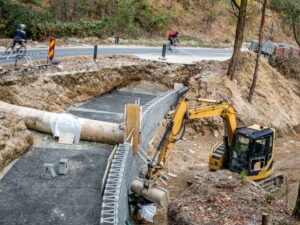 A construction survey locates those limits before design and stakes the work so it lands where the approved plan says. Start the construction survey while the improvement is still a sketch, and you’ll avoid building something the road authority can make you remove. The edge of pavement is a bad guide to where your property ends. In most places, the public right of way runs well past the curb, and anything built inside it may need a permit, a removal agreement, or a demolition crew.
Understanding Right of Way Limits Before Planning Improvements
Right of way lines come from recorded plats, road maps, deeds, and dedication documents. The width can change from one block to the next, and it often includes the sidewalk, the swale, utility poles, and a strip of grass owners have mowed for years. That strip may look like part of the lot, but it usually belongs to the public.
Planned road work adds another layer. Some roads have reserved or future right of way for widening, and some jurisdictions ask for dedications when a property redevelops. Requirements vary by municipality, county, state road agency, and project type, so ask early whether any apply to your site.
Owners planning these improvements run into right of way questions most often:
- Monument signs and pole signs
- Fences, walls, and gates along the frontage
- Parking expansions and new driveway connections
- Drive-thru lanes and canopy additions
- Landscaping, lighting, and irrigation near the street
Establishing Property Boundaries Through a Construction Survey
Accurate layout starts with an accurate boundary. The surveyor researches the plat and road records, recovers corner markers, and locates the right of way line along every frontage. Where records conflict or markers are missing, the surveyor resolves the line based on the evidence.
The drawing should show the property line, the right of way line, edge of pavement, curbs, sidewalks, and visible utilities. Recorded easements belong on it too, since utility and drainage easements often run just inside the right of way. Seeing all of that together tells your designer how much frontage space is truly usable.
Ask for the data in a CAD format your engineer or architect can use. The same coordinates and control will carry into staking later. That consistency keeps the design and the field layout from drifting apart.
Reviewing Setbacks and Access Restrictions Near the Right of Way
Many setbacks are measured from the right of way line. If the line sits farther back than you assumed, the buildable area shrinks along with it. Setback rules for signs, walls, parking, and buildings can differ, and they vary by zoning district and jurisdiction.
Access gets its own review. New driveways, curb cuts, and changes to existing connections usually need approval from whoever controls the road. Spacing from intersections, sight distance, and turn lane requirements can all affect where a driveway goes.
Visibility rules matter near intersections and driveways. Many codes limit walls, signs, and landscaping inside sight triangles so drivers can see traffic. Confirm the rules with the permit office before finalizing heights and locations.
Using Construction Survey Staking to Position Improvements Accurately
Once the plan is approved, staking puts it on the ground. The surveyor sets marks for the right of way line, the corners of new structures, sign foundations, fence posts, curb lines, or driveway edges. Offset stakes give crews reference points that survive excavation.
Walk the staked layout with your contractor before work begins. Check distances to the right of way line, setbacks, and any easement limits. A shifted stake costs almost nothing to fix, and a poured footing in the wrong place costs a lot.
Call 811 before digging. Right of way strips are often packed with water, sewer, power, gas, and communication lines. The construction survey shows visible features and recorded easements, but buried lines still need to be marked.
Verifying Completed Improvements Against Approved Site Plans
After construction, a final or as-built survey records what was actually built. It shows the location of the new improvements relative to the property line, the right of way, and setbacks. Some jurisdictions and road agencies ask for it before closing a permit or accepting work.
Compare the as-built with the approved plan. Look at sign and wall locations, driveway widths, curb positions, and anything near the right of way line. Small differences may be acceptable, while larger ones may need review by the engineer or permitting agency.
Keep the as-built with your property records. Future buyers, lenders, and title companies may ask whether anything encroaches into the right of way. A current drawing answers that question quickly.
Frequently Asked Questions
When should I order a construction survey for work near a right of way?
Order it at the start of design, before the site plan is drawn. Boundary and right of way data shape where improvements can go and what approvals you need. Staking follows once the plan is approved. If permits or construction dates depend on the construction survey, schedule it right away.
Can I build a fence or sign inside the right of way?
Usually not without permission from the road authority, and some improvements are prohibited outright. Rules vary by municipality, county, and road agency. Even permitted items may have to be removed if the road is widened. Confirm requirements before you design anything near the street.
How do I know where the right of way line is?
A construction survey locates it from recorded plats, road records, and field evidence. The line often sits well behind the curb or sidewalk. Online parcel maps aren’t accurate enough to build from. Ask the surveyor to mark the line on site if you’re planning work nearby.
For a free land surveying quote, call us at (305) 912-7795 or send us a message by going here.
Posted in construction survey | Tagged construction survey