
Fence Projects Go Wrong When Homeowners Ignore These Survey Markers
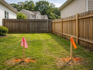
Skipping a land survey for fence installation is one of the most expensive mistakes a homeowner can make. A fence built even a few inches over the property line can trigger a neighbor complaint, a city violation, or a forced removal at your own cost. This article explains what survey markers are, why they matter for fence projects, and what happens when homeowners ignore them.
What Are Survey Markers and Why Do They Matter?
Survey markers are physical points set by a licensed surveyor to show where one property ends and another begins. In Hialeah, they’re usually metal rods or iron pins driven into the ground at the corners of a lot. Some older properties use concrete monuments or aluminum caps.
These markers are the legal reference points for your property line. They’re not suggestions. They’re part of the recorded plat for your lot, and they hold up in court if a dispute goes that far.
The problem is that most homeowners have never seen theirs. Markers get buried under grass, covered by landscaping, or knocked off by construction equipment over the years. Out of sight means out of mind, and that’s where fence projects start going sideways.
How Ignored Survey Markers Cause Real Problems
The Fence Goes Up in the Wrong Place
This is the most common outcome. A homeowner eyeballs the yard, picks what looks like the right line, and builds. Without confirmed survey markers, that estimate is often wrong by several inches or a few feet.
In dense Hialeah neighborhoods where lots run narrow, a few inches matter a lot. A fence that sits 6 inches over the line is still over the line. The neighbor has every right to ask for it to be moved, and the city can back that request up with a code enforcement order.
Permit Applications Get Rejected
Hialeah requires a permit for most fence installations. The permit application asks for a site plan showing the fence location relative to the property lines. If you don’t know exactly where your lines are, you can’t fill that out accurately.
City reviewers catch mismatched surveys. A permit based on a guessed property line gets flagged or denied. That delays the whole project and may require you to hire a surveyor anyway, after you’ve already paid for materials and labor.
Neighbor Disputes Turn Legal
A fence built over the line doesn’t just annoy a neighbor. It can become a legal encroachment. Florida property law allows a neighbor to pursue removal of any structure that crosses their property line, and they can seek damages for the time it sat there.
Miami-Dade County courts handle a steady volume of boundary disputes each year. Many of them start with a fence. Legal fees add up fast, and the losing party often ends up paying to tear down and rebuild the fence in the correct location.
Easements Get Blocked
Many Hialeah lots carry utility or drainage easements along the rear or side boundaries. These easements are recorded in the property deed and on the plat. Fences built across an easement can block utility access, and the utility company has the legal right to remove the fence without compensating the homeowner.
A land survey for fence planning shows easement locations clearly. Building without that information is a gamble, especially on older lots where drainage easements run along rear lot lines.
What a Survey for Fence Projects Actually Covers
A boundary survey for a fence project locates and confirms all property corners, marks the lot lines on the ground, and provides a drawing showing the legal boundaries of the parcel. Some surveyors will also flag or stake the line at intervals so the fence contractor has physical reference points to work from.
A survey for a residential fence typically takes one to two days from fieldwork to final drawing. The cost varies based on lot size, how many corners need to be found, and how long ago the parcel was last surveyed. Lots that haven’t been surveyed recently take more time because the surveyor has to research the original plat and locate reference monuments in the neighborhood.
A survey also catches any discrepancies between what’s recorded and what’s on the ground. If a previous fence was already over the line, a new survey catches that before you replicate the mistake.
When to Get a Survey Before Your Fence Project
Get a survey before you pull a permit. That’s the cleanest order of operations. The survey gives you accurate boundary data, the site plan reflects those boundaries, and the permit application goes in clean.
If you’re in a rush, at least have a surveyor locate and flag your property corners before the fence contractor starts digging. That takes less time than a full boundary survey and still gives your contractor real reference points to work from.
Don’t wait until a neighbor complains or code enforcement shows up. By then, the fence is already built, and moving it costs far more than the original survey would have.
Frequently Asked Questions
Why Is a Land Survey Important Before Building a Fence?
Hialeah fence permits require a site plan that shows the fence location relative to confirmed property lines. Without a survey, homeowners can face permit delays, neighbor disputes, and potential code violations.
What Happens If a Fence Is Installed Across a Property Line?
A fence built over a property line is considered an encroachment. A neighbor may request its removal, and the city can issue a code enforcement order. In most cases, the homeowner who installed the fence is responsible for the cost of relocating it.
Can County Property Maps Be Used to Locate Fence Boundaries?
No. County appraiser maps and online parcel tools are intended for general reference only. They are not survey-accurate and cannot legally establish property lines. A boundary survey performed by a licensed Florida surveyor provides the most reliable information.
How Long Does a Boundary Survey for a Fence Usually Take?
Most residential boundary surveys in Hialeah can be completed within one to two business days after fieldwork begins. Older properties or parcels with complicated histories may require additional research and take longer.
What Is the Difference Between a Boundary Survey and a Location Sketch?
A boundary survey is completed by a licensed surveyor and legally establishes property corners and lines. A location sketch is a simpler drawing that may satisfy some permit requirements but does not provide the same level of legal certainty. For fence projects, a full boundary survey offers greater protection.
For a free land surveying quote, call us at (305) 912-7795 or send us a message by going here.
Posted in land surveying, land surveyor | Tagged cost of land surveying, estimating the cost of land surveying, land surveying cost, land surveying cost Hialeah