
How a Metes and Bounds Survey Clarifies Old Deeds
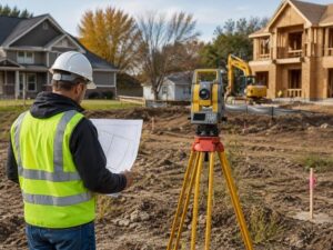
Buying or developing older property can get messy fast. Many old deeds use vague language. Some mention trees, fences, rocks, canals, or roads that no longer exist. Others were written decades before modern mapping tools became common.
That creates problems for developers.
A metes and bounds survey helps clear up that confusion. It turns an old written property description into measured boundary lines that can be mapped, checked, and used for planning.
Why Old Deeds Create Problems
Older deeds often describe land with directions and distances instead of modern lot numbers. That system is called metes and bounds.
A deed may say something like:
- Begin at the large oak tree
- Continue south 200 feet
- Turn east toward the canal
- Follow the fence line to the road
The issue is obvious. Trees die. Fences move. Roads change. Canals get widened or filled.
A developer may think the property includes one section of land, while a neighboring owner believes something different.
That can delay projects, financing, permits, and sales.
What Is a Metes and Bounds Survey?
A metes and bounds survey measures property boundaries using:
- Distances
- Angles
- Physical markers
- Historical deed records
- Existing monuments
Surveyors compare the old legal description with current site conditions. They also review nearby deeds and prior surveys.
The goal is simple: locate the true boundary as accurately as possible.
Why Developers Run Into Trouble With Old Legal Descriptions
Developers often buy older parcels for:
- Redevelopment
- Mixed-use projects
- Small subdivisions
- Commercial expansion
- Warehouse construction
Older tracts usually have a longer ownership history. That history can create overlapping descriptions or unclear property corners.
A metes and bounds survey helps identify problems before construction starts.
Missing Boundary Markers
Some old deeds rely on landmarks that no longer exist.
That forces the surveyor to rebuild the boundary using nearby records and measurements.
Overlapping Claims
Two neighboring deeds may describe the same strip of land.
That can lead to disputes during title review or site planning.
Incorrect Assumptions
Developers sometimes rely on fence lines or pavement edges. Those features may not match the legal boundary.
That mistake can become expensive during construction.
How Surveyors Clarify Old Deeds
Surveyors do more than measure land. They investigate property history.
That process usually includes several steps.
Reviewing Historical Records
The surveyor studies:
- Old deeds
- Prior surveys
- Plat maps
- Easement records
- County documents
Small wording differences matter. One missing direction or distance can change the boundary location.
Locating Existing Monuments
Surveyors search for physical markers such as:
- Iron rods
- Concrete monuments
- Pipes
- Nail markers
Some markers may be buried or damaged. Others may not match the written description.
Comparing Neighboring Properties
Boundary lines must connect logically with nearby parcels.
If one deed conflicts with another, the surveyor works through the chain of title to find the stronger legal position.
Mapping the Final Boundary
Once the evidence is reviewed, the surveyor creates a map showing:
- Boundary lines
- Corners
- Encroachments
- Easements
- Improvements near property lines
Developers use this map during planning and permitting.
Common Issues a Metes and Bounds Survey Can Reveal
Many property owners assume old deeds are accurate. That assumption causes trouble.
A survey may uncover issues that were hidden for years.
Encroachments
A neighboring fence, driveway, shed, or wall may cross the property line.
Developers need to know this before site work begins.
Gaps Between Parcels
Some older descriptions leave small strips of land unclaimed.
Those gaps can affect access or development plans.
Easement Conflicts
Utility or drainage easements may limit where construction can happen.
Older deeds do not always describe those restrictions clearly.
Boundary Line Disputes
Conflicting deed descriptions can trigger legal disagreements between neighboring owners.
A survey creates documented evidence that attorneys and title companies can review.
Why This Matters Before Development
Boundary mistakes cost money.
A developer may already have:
- Architectural plans
- Engineering work
- Permit applications
- Contractor schedules
Then the survey reveals a property issue.
That delay can affect financing and construction timelines.
Ordering a metes and bounds survey early helps reduce risk before major spending begins.
Metes and Bounds vs. Lot and Block Surveys
Modern subdivisions often use lot and block descriptions. Those are tied to recorded plats with fixed lot numbers.
Metes and bounds descriptions are different.
They depend on measurements and directional calls instead of subdivision lots.
That usually means more research is needed.
Older parcels often require deeper investigation because the original descriptions were written long before modern GPS equipment existed.
Signs a Property May Need a Metes and Bounds Survey
Developers should pay attention when:
- The deed description looks unusually long
- The property is older
- Multiple owners held the land over many decades
- Fence lines look inconsistent
- Title records mention exceptions
- No recent survey exists
Those warning signs often point to hidden boundary problems.
Questions Developers Should Ask Before Buying Older Land
Before closing on older property, ask:
Has the property been surveyed recently?
A survey from many years ago may not reflect current conditions.
Do neighboring owners agree on the boundaries?
Disputes sometimes exist long before a project begins.
Are there visible encroachments?
Driveways, fences, and utility lines should be checked carefully.
Does the deed rely on outdated landmarks?
Natural markers create problems when they disappear.
Frequently Asked Questions
What does metes and bounds mean in land surveying?
Metes and bounds is a legal method used to describe property boundaries with directions, distances, and physical landmarks.
Why are old deeds harder to interpret?
Older deeds often reference landmarks that changed or disappeared over time. Some also contain inconsistent measurements.
Can a metes and bounds survey help with boundary disputes?
Yes. A survey provides measured boundary evidence that attorneys, title companies, and property owners can review.
Do developers need a metes and bounds survey before construction?
Many do. It helps identify encroachments, boundary conflicts, and easement issues before development begins.
How long does a metes and bounds survey take?
The timeline depends on property size, record availability, and boundary complexity. Older parcels often require more research.
For a free land surveying quote, call us at (305) 912-7795 or send us a message by going here.
Posted in land surveying, land surveyor |