
How the Permit Process Can Reveal Survey Problems Before Construction Starts
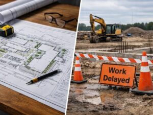
A permit application does more than request approval. It holds your project up against official records. Land surveying data is part of that check. When the two don’t match, the city puts the application on hold.
Work stops before it starts.
Most developers assume the permit review is a formality. It isn’t.
This covers what the permit process checks, what problems it finds, and why catching those problems early is always the better outcome.
Why Permit Applications Often Uncover Forgotten Property Restrictions
When you submit a permit application, staff pull the recorded plat, the legal description, the zoning file, and prior permits on the parcel. Then they compare all of that against your site plan.
Restrictions nobody mentioned during the sale show up here.
A deed restriction from a 1970s subdivision may limit how close a structure can sit to the street. A utility easement may run through the planned building footprint. A drainage restriction tied to a canal right-of-way may limit how much of the lot can be paved.
These restrictions never went away. They were just forgotten.
Land surveying shows where these restrictions sit on the ground. A current survey shows the easement corridor, the restricted zone, the right-of-way line. When that information is in hand before the permit is submitted, the site plan can avoid conflicts.
When it’s not, the building department finds the conflict during review and sends the application back.
That review process takes time. Starting it over takes more.
How Incomplete Permit Histories Can Create Problems for New Projects
Every permit pulled on a parcel in Hialeah leaves a record. Open permits, expired permits, permits never finaled, they all sit in the city’s system. They all affect new applications.
An open permit from fifteen years ago can flag a new commercial permit. The city may require the old permit to be resolved first.
This is more common on older properties than most buyers expect. A prior tenant may have pulled electrical permits and never closed them. An owner may have started a structural change, stopped the work, and never finalized the permit. The current owner inherits all of it.
Incomplete permit histories also affect how the building department views existing improvements. If a structure was built without a permit, it may not appear in the official record at all.
Land surveying documents what actually exists on the property right now. That gives a developer a clear picture of which improvements are permitted and which ones aren’t. Knowing that before submitting saves time during review.
When Existing Buildings No Longer Match Recorded Site Documents
Properties change over time. Tenants build out. Owners add structures. Drainage gets rerouted. Pavement gets extended. Most of that happens without anyone updating the official site documents.
By the time a developer buys an older property in Hialeah, the original recorded site plan may look nothing like what’s on the ground today.
That gap matters during permit review. The building department compares the new application against recorded documents. If the existing conditions don’t match what’s on record, the reviewer asks questions. Sometimes they require a full existing conditions survey before the application can move forward.
A current land survey fixes this before the application is submitted. It documents every existing structure, every paved surface, every drainage feature.
Skipping this step rarely saves time. It usually adds a review cycle and delays the approval.
Why Zoning and Survey Records Do Not Always Agree
Zoning maps and recorded surveys are kept by different agencies. They don’t always match, and the gaps between them cause real problems for permit applications.
A zoning map may show a parcel as a single use, but a survey reveals the parcel was partially replatted years ago. A zoning file may show a setback based on a lot width that no longer matches the recorded plat.
In Hialeah, some older commercial areas have gone through multiple rounds of rezoning and road widening. Each change may have affected parcel dimensions or setbacks without every agency updating every record at the same time.
When a developer draws site plans from zoning records without checking a current survey, the plan may not match what the county actually shows. The permit reviewer catches the gap. The application goes back for revision.
Comparing zoning records against a current survey before drawing site plans prevents this.
Fixing Property Record Issues Before Contractors Arrive Saves More Than Time
Once contractors mobilize, the cost of a problem goes up fast. Equipment is on-site. Crews are scheduled. Material deliveries are lined up.
A stop-work order doesn’t just pause the project. It runs up costs while the developer works through a revision or a variance application. Neither process moves quickly.
Fixing the same issue before a permit is approved costs far less.
For developers, the sequence that avoids problems is straightforward:
- Get a current land survey before drawing any site plans
- Compare that survey against the recorded plat, the zoning file, and prior permit history
- Find any gaps between current conditions and official records
- Resolve those gaps before submitting the permit application
A permit application built on accurate, current survey data moves through review faster. It also gives contractors a site plan that matches what’s on the ground, which reduces problems once work begins.
Discovering a record problem after the slab is poured is an expensive lesson every time.
Frequently Asked Questions
Can a permit application be rejected because of an old survey?
Yes. If the site plan is based on an old survey, the building department may flag it. The application can be held until a current survey is provided. This is common on older properties in Hialeah where site conditions have changed.
Does the City of Hialeah require a survey with every permit?
Not every permit type requires one. Minor interior work may not. But new construction, additions, or site changes will typically require a current site plan drawn from accurate survey data. Contact the Hialeah Building and Zoning Department to confirm what your project needs.
What happens if a prior owner built without a permit?
An unpermitted structure won’t appear in county records. When a new site plan shows it, the reviewer may ask for documentation or require the structure to be permitted or removed. A current land survey shows what exists on the property so a developer knows what has permit history and what doesn’t.
How does an open permit from a prior owner affect a new application?
Open permits in Florida can block new permits until they are resolved. Fixing an open permit may require an inspection or a code compliance review. Developers buying older commercial properties in Hialeah should pull a permit history search from Miami-Dade County records before closing.
For a free land surveying quote, call us at (305) 912-7795 or send us a message by going here.
Posted in land surveying, land surveyor | Tagged cost of land surveying, estimating the cost of land surveying, land surveying cost, land surveying cost Hialeah