
What an Elevation Certificate Can Reveal
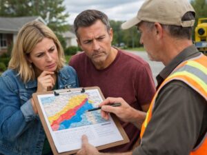
Most property owners don’t think about an elevation certificate until someone asks for one. By then, they’re already in the middle of a permit review, an insurance renewal, or a closing that’s about to fall apart. This document tells you more about a property’s flood risk than almost anything else. Here’s what it actually reveals and why developers should care about it early.
Reading the Numbers on an Elevation Certificate
An elevation certificate is an official document. A licensed surveyor fills it out. It records the height of a building’s lowest floor compared to the Base Flood Elevation set by FEMA for that flood zone.
It’s not just a form. It’s a snapshot of a property’s relationship to flood risk at a specific point in time. It tells insurers, lenders, city reviewers and future buyers exactly where the building sits relative to the flood zone it’s in.
In Hialeah, most parcels fall within Miami-Dade County’s FEMA-mapped flood zones. Some are high-risk zones. Others are moderate. The elevation certificate tells you which zone applies to the specific property and what the measured floor heights actually are.
Four Things the Certificate Puts on Record
The Flood Zone for That Specific Parcel
The certificate identifies the FEMA flood zone for that parcel. Zone AE means there is a mapped Base Flood Elevation and a high risk of flooding. Zone X means lower risk. Zone VE applies to coastal areas with wave action.
Many Hialeah properties sit in AE zones. That classification alone affects permit requirements, insurance costs and what lenders will accept as adequate coverage.
The Freeboard Gap
This is the number that matters most. The certificate shows the lowest floor elevation. It also shows the Base Flood Elevation for the zone. The difference between those two numbers is called freeboard.
If the floor sits below the BFE, that gap means higher insurance costs. If it sits above, the owner pays less. In Miami-Dade, being just one foot below the BFE can cost a property owner several thousand dollars more per year in flood insurance premiums.
Being two feet above the BFE can cut those premiums by more than half compared to a building right at the minimum level.
Ground Elevation Right Next to the Building
The certificate records the lowest ground elevation right next to the building. This number matters for drainage. It shows whether water pooling around the foundation is a real risk. It also affects how the building is rated by flood insurers.
A building with a very low adjacent grade, even if the floor itself is high enough, can still get unfavorable insurance ratings in certain flood zones.
Enclosed Spaces Below the Flood Level
If a building has any enclosed area below the Base Flood Elevation, the certificate documents it. Garages, storage rooms and utility spaces that sit below the BFE must meet specific flood opening requirements under Miami-Dade codes.
Missing those requirements at the design stage causes problems later. Code reviewers check the elevation certificate against the plans. If they don’t match, the permit stalls.
Why Ordering This Document Late Costs More
Some developers wait until late in the design process to think about the elevation certificate. That’s a mistake. By then, the floor elevation is already set in the plans. If it’s wrong, changing it means redesigning the structural drawings, the grading plan and sometimes the utility connections.
Getting the elevation certificate information before design begins lets the engineer set the finished floor elevation correctly the first time. It also confirms the flood zone classification for the specific parcel, which isn’t always obvious from looking at a general flood map.
Two adjacent lots in Hialeah can be in different flood zones. One might be in AE. The other might be in X. The design requirements and insurance costs are different for each one. Only a site-specific survey confirms which zone applies to the actual parcel being built on.
What Buyers and Lenders See in This Document
When a property sells, lenders in high-risk flood zones require flood insurance as a condition of the loan. The insurance premium is based largely on what the elevation certificate shows.
A certificate that shows the building sitting well above the BFE leads to lower premiums and a smoother closing. A certificate showing the building at or below the BFE can raise the insurance cost enough to affect whether a buyer can afford the property.
Buyers sometimes discover a bad elevation situation for the first time during closing. That’s a bad time to find out. Developers who have a current elevation certificate ready before listing give buyers accurate insurance cost information upfront.
When the Existing Certificate No Longer Applies
An elevation certificate doesn’t expire on a fixed schedule. But it can become outdated. If FEMA updates the flood maps for an area, an older certificate based on the previous map may no longer reflect the correct BFE. When Hialeah or Miami-Dade releases updated Flood Insurance Rate Maps, properties near zone boundaries sometimes move into or out of high-risk zones.
Any time a building is substantially renovated or the site grading changes, the existing certificate may no longer be accurate. A licensed surveyor needs to prepare a new one based on current conditions.
Frequently Asked Questions
What Information Is Included on an Elevation Certificate?
An elevation certificate shows how a building’s floor elevations compare to the FEMA Base Flood Elevation. It also identifies the flood zone, records the lowest adjacent ground elevation, and provides details about enclosed areas below the flood level.
Who Can Prepare an Elevation Certificate?
A licensed Florida land surveyor is responsible for preparing and certifying an elevation certificate. The surveyor performs field measurements and completes the official FEMA form.
Which Properties Need an Elevation Certificate?
Not every property requires one. Homes and buildings located in high-risk flood zones, such as Zone AE, often need an elevation certificate for flood insurance, lending requirements, or permitting purposes. Properties in lower-risk areas may only need one if requested by a lender or insurance company.
Can an Elevation Certificate Help Reduce Flood Insurance Premiums?
Yes. If the certificate shows that the building’s lowest floor is above the Base Flood Elevation, insurance providers may view the property as a lower risk, which can result in reduced flood insurance costs.
When Should an Elevation Certificate Be Updated?
A new elevation certificate may be needed after significant renovations, grading changes, or updates to FEMA flood maps. Older certificates based on outdated information may no longer reflect current flood zone classifications or insurance requirements.
For a free land surveying quote, call us at (305) 912-7795 or send us a message by going here.