What Is a Boundary Survey and When Do You Need One?
 A boundary survey is a professional measurement done by a licensed land surveyor to find the exact legal edges of a property. It identifies corners, sets property lines, and helps resolve conflicts between a deed description and the actual land.
A boundary survey is one of the most important steps a property owner can take. It tells you exactly where your land begins and ends. A licensed land surveyor uses records, deeds, and modern tools to measure your property and mark each corner. The result is a legal document called a plat or survey map.
This is not the same as a home inspection. A home inspection checks the condition of a building. A boundary survey checks the legal limits of the land itself. In Florida, only a licensed Professional Land Surveyor (PLS) can perform and certify this type of work.
What Does a Boundary Survey Include?
A boundary survey includes the location of all property corners, measurements of boundary lines, notes on encroachments, and a certified survey map. It is a legal document used in real estate, construction, and property dispute cases.
Here is what you get with a boundary survey:
- Location of all property corners, marked with iron pins or concrete monuments
- Measurements of all boundary lines, including distances and directions
- Notes on encroachments, such as a neighbor’s fence crossing your line
- Identification of easements and rights-of-way recorded in public documents
- A certified, signed, and sealed survey map
How Does a Boundary Survey Work?
A boundary survey has three phases: research, fieldwork, and documentation. The surveyor pulls records and deeds, visits the property to take measurements, and then drafts a certified map. Most residential surveys take one to three weeks to complete.
Phase 1: Research The surveyor pulls county records, deed books, and old plat maps. This step helps them understand the history of the property before any field visit.
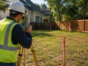
Phase 2: Fieldwork The surveyor visits the property with GPS tools and measuring equipment. They locate existing markers, take all measurements, and note anything that does not match the deed.
Phase 3: Documentation The surveyor drafts a scaled map, sets new corner markers where needed, and delivers a signed and sealed plat. This plat is a legal document you can use in court or when applying for permits.
In Florida, boundary surveys must follow the Minimum Technical Standards under Chapter 5J-17, Florida Administrative Code.
When Do You Need a Boundary Survey?
You need a boundary survey before buying property, building a fence, starting construction near a property line, or settling a neighbor dispute. Lenders and title companies may also require one at closing.
Before Buying or Selling Property. A buyer who skips a boundary survey may take on encroachments, disputed lines, or deed errors without knowing it. Getting a survey before you sign protects your purchase.
Before Building a Fence. Most Florida counties require fences to be built on or inside your property line. A boundary survey keeps you on the right side of local rules and avoids fights with neighbors.
Before a Home Addition or New Construction. Building permits require proof that your structure meets setback rules. A boundary survey confirms your plans are within the legal limits before you start.
To Resolve a Property Line Dispute. When neighbors disagree about where a line falls, a certified boundary survey is the legal way to settle it. Courts rely on licensed surveyors and their sealed plats.
Before Installing a Pool, Deck, or Driveway. Permanent improvements built across a property line may have to be removed by law. A boundary survey protects your investment before you pour a single drop of concrete.
After Inheriting Property. Inherited land often comes with old or unclear legal descriptions. A current boundary survey tells you exactly what you own before you sell, build, or make any decisions.
Boundary Survey vs. Other Survey Types
A boundary survey focuses on property lines only. Here is how it compares to other common types:
Survey Type | What It Does |
Boundary Survey | Finds your legal property lines |
Topographic Survey | Maps the elevations and land features |
ALTA Survey | A detailed survey for commercial use |
As-Built Survey | Records completed construction |
Mortgage Survey | A basic sketch for loan purposes |
Each type serves a different purpose. Always confirm with your surveyor which one fits your specific need.
How Much Does a Boundary Survey Cost?
In Florida, most residential boundary surveys cost between $400 and $900. Larger lots, irregular shapes, or limited records can push the price up. Rural or complex parcels may cost $1,500 or more.
Several things affect the final price:
- Lot size: Bigger lots take more time and fieldwork
- Shape: Irregular or curved boundary lines are harder to measure
- Records: Older or missing deeds mean more research time
- Terrain: Wooded or waterfront land takes longer to survey
- Urgency: Rush jobs may carry an added fee
According to the American Land Title Association (ALTA), the average cost of a basic residential boundary survey in the Southeastern U.S. runs from $500 to $800.
Frequently Asked Questions
How long is a boundary survey valid?
There is no official expiration date. Most lenders and title companies prefer surveys that are no older than five to ten years. If major changes have been made to the property, a new survey is a smart move.
What if the survey finds a problem?
If the survey shows a conflict, such as a neighbor’s fence crossing your line, the surveyor will document it. You can resolve it through a signed boundary agreement or through legal action.
Is a boundary survey the same as an ILC?
No. An Improvement Location Certificate (ILC) is a cheaper sketch that shows approximate locations of improvements. It does not establish legal property lines and cannot be used to settle a boundary dispute.
For a free land surveying quote, call us at (305) 912-7795 or send us a message by going here.
Posted in land surveying, land surveyor |