
When Drone Land Surveying Makes Sense for Tight Urban Lots
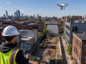
Tight urban lots are hard to survey the old way. Crews squeeze between fences, dodge traffic and lose hours setting up gear in spaces with no room to spare. Drone land surveying changes the math on sites like these. A drone flies the lot in minutes and captures data a ground crew would take days to collect. For developers on cramped infill lots, that speed can make or break the budget. Drones are not the right tool for every job. But on a small, boxed-in parcel, they often beat the alternatives on cost and time. Here is when a drone survey makes sense, and when you still need boots on the ground.
How Drone Surveys Help Before Urban Redevelopment Begins
Before you redevelop a city lot, you need to know what is there. Drones map the whole site fast. A drone flies a grid over the parcel and snaps hundreds of overlapping photos. Software stitches those into a scaled model with elevations and measurements. You get a current picture of the lot before site planning and design start . The model shows building heights, paved areas and the rooflines next door. You see how your lot sits against everything around it. On a tight city block, that data flags problems you cannot see from the street. You spot grade changes, property overlaps and old structures with time to fix the plan. Find them early. That beats finding them after you tear things down.
Capturing Existing Site Conditions Without Interrupting Nearby Activity
Urban sites are busy. Traffic moves, businesses run, neighbors come and go. A ground crew with tripods and tape blocks sidewalks and slows everything down. A drone skips most of that. It flies above the noise and captures the site without closing a lane or knocking on doors. The pilot works from one safe spot and covers the whole lot from the air. That keeps the street open and the neighbors calm. You collect data on a live block without shutting it down. You can also fly the same lot again later in the project. That gives you a record of how the site changes over time. Less friction on site means fewer delays and fewer complaints.
Why Tight Property Lines Require Careful Flight Planning
Small lots leave no margin for error. Your property line might sit a few feet from a neighbor’s roof or a public road. The pilot has to plan the flight around those edges. They set the flight path, the height and the camera angle. The goal is to cover your lot and stay off the neighbor’s. Airspace rules add another layer. Many city lots sit near airports. So the pilot needs the right clearance before takeoff. Wind and tall buildings near a small lot also shape the plan. The pilot picks a launch spot clear of power lines and signs. A rushed plan risks gaps in the data. It can also break the rules. Good planning up front keeps the survey legal and complete.
How Aerial Data Supports Architects and Civil Engineers
The data from a drone does not just sit in a folder. Your design team puts it to work. Architects pull the model into their software. They design around the real grades and setbacks. Civil engineers use the elevation data to plan grading, drainage and access. The model also lets them pull distances and volumes right off the screen. They check cut and fill without a second trip to the site. Everyone works from the same accurate base. That cuts the back-and-forth from old or rough surveys. The aerial model also gives clear visuals for permits and client meetings. A clear aerial map explains the site faster than a stack of numbers.
Knowing When a Drone Survey Should Be Combined With Ground Measurements
A drone is great, but it has limits. It sees what the camera sees from above. It cannot find a property corner hidden under a bush. It cannot set a legal boundary marker. For those jobs, you still need a surveyor on the ground. The best results often come from pairing the two. A licensed surveyor sets the control points and confirms the legal boundaries. The drone fills in the surface detail fast. Think of the drone as the quick first pass. The surveyor has the final word.
A drone speeds up the work. A licensed surveyor makes it official. Use both and you get fast data you can actually file.
Frequently Asked Questions
What is drone land surveying?
It is the use of an unmanned aircraft to map a site from the air. The drone takes overlapping photos or laser scans, and software turns them into a scaled model with elevations. Survey teams use it to capture site data faster than ground methods alone.
Is drone surveying accurate enough for development?
Yes, when set up right. With ground control points and the right gear, a drone survey hits the accuracy most site planning needs. The exact tolerance depends on the gear and the flight. For legal boundaries, a licensed surveyor still has to verify the results.
Do I need a licensed surveyor if I use a drone?
For most official work, yes. A drone collects data, but it does not replace a licensed surveyor’s stamp. A licensed pro must sign off on boundary surveys and recorded plats. The drone speeds up the field work behind that final product.
Can a drone survey a lot near an airport?
Often, but it takes clearance. Lots near airports usually sit in controlled airspace. The pilot needs approval before the flight. Some spots carry hard limits. A qualified drone operator checks the airspace and gets approval before takeoff.
How long does a drone survey of an urban lot take?
The flight itself can run well under an hour for a small lot. Processing the data into a usable model takes longer, often a day or more. Even so, the full turnaround usually beats a ground survey on a cramped site.
For a free land surveying quote, call us at (305) 912-7795 or send us a message by going here.