
Topographic Survey Details That Can Affect Slab Construction
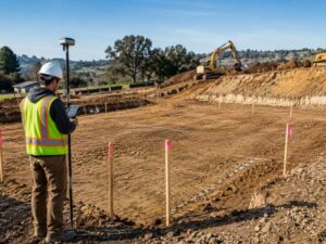
A concrete slab looks simple. You pour it, you build on it, you move on. The ground underneath tells a different story. A topographic survey before building maps that ground before anyone pours, and the details it captures can make or break your slab. Skip them and you risk cracks, settling and changing orders that drain your budget. Read them right and the whole build goes smoother. Here is what topographic data tells you about your slab before the first truck shows up.
How Ground Elevation Changes Affect Slab Design
Land is rarely flat. Even a lot that looks level can drop several inches across its width. A topographic survey shows those changes as contour lines. Your slab design leans on them. A flat slab on sloped ground means deep fill on one side or a stepped foundation. Each choice changes the rebar, the thickness and the cost. Get the elevation wrong and your slab sits too high or too low for the doors, the utilities and the street. Engineers use the survey to set the finished floor height. That one number drives the whole design.
Why Drainage Patterns Matter Before Pouring Concrete
Water flows downhill. Your survey shows where it goes. It maps the high points, the low points and the path runoff takes across the site. That matters because water is a slab’s worst enemy. If the ground slopes toward your foundation, rain pools against it. Over time that water softens the soil and the slab settles. Cracks follow. A good survey lets you grade the lot so water moves away from the slab, not into it. You plan swales, slopes and drains before the concrete locks everything in place. Fix drainage on paper. It costs far less than fixing it after the pour.
How Cut and Fill Areas Influence Foundation Preparation
Cut means you take dirt away. Fill means you add it. Most sites need both to reach a level pad. The survey tells you how much of each and where. This matters for your slab because cut ground and fill ground act differently. Undisturbed ground in a cut area is usually firm. You have to pack, fill in layers and compact it, or it keeps sinking under load. A slab that sits half on cut and half on loose fill can crack right down the middle. Your survey marks these zones early. The crew compacts the fill to the right density before any concrete shows up.
Existing Site Features That Can Impact Slab Placement
A topographic survey catches more than dirt. It records the things on and under your site that shape where the slab can sit. Common finds include trees, old foundations, buried tanks, utility lines and drainage structures. An old septic tank under your pad is a problem you want to find before you dig, not during. Tree roots and big boulders change your excavation plan. Utility lines set hard limits on where you can build. The survey puts all of it on one map. You design the slab around what is really there instead of guessing.
Why Accurate Topographic Data Helps Prevent Costly Construction Changes
Change orders kill budgets. Most of them trace back to surprises in the ground. A precise topographic survey takes the guesswork out before you commit. You know the grades, the drainage paths and where the fill goes up front. That means your structural engineer designs the right slab the first time. Your contractor bids on real numbers, not hopes. When the data is solid, the crew pours once and moves on. When it is vague or old, you find out mid-build, and every fix costs more than it would have on paper. Good data is cheap. Rework is not.
Frequently Asked Questions
What is a topographic survey for slab construction?
It is a detailed map of your site’s surface. It shows elevation changes, slopes, drainage paths and existing features like trees and utilities. Your design team uses it to plan the slab, the grading and the foundation prep before any work begins on the ground.
Can I pour a slab without a topographic survey?
You can, but it is a gamble. Without one, you guess at the grades and the drainage. Those guesses turn into settling, cracks and expensive fixes later. The survey costs little next to the price of repairing a failed slab.
How does a topographic survey affect slab cost?
It shapes nearly every cost on the pad. The grades set how much cut and fill you need. The drainage plan sets your grading work. Accurate data lets your contractor bid tight and avoid mid-project change orders that blow up the budget.
How is a topographic survey different from a soil test?
A topographic survey maps the surface, the slopes and the features you can see. A soil test, done by a geotechnical firm, tells you how strong the ground is below. You often need both. One plans the shape of the pad. The other confirms it can hold the load.
When should developers order a topographic survey for a slab project?
Order it first, before design and grading. The survey gives your engineer the real grades and features to work from. Waiting until after design means redoing the plans when the ground does not match. Early data keeps the schedule and the budget on track.
For a free land surveying quote, call us at (305) 912-7795 or send us a message by going here.