
Why Low-Elevation Land Needs a Topographic Survey
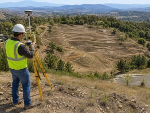
Building on flat land sounds simple. It’s not.
Low-elevation land looks easy to develop. No steep slopes. No dramatic grade changes. But that flat surface hides real problems. Water has nowhere to go. Soil shifts. Drainage fails. And by the time you find out, you’ve already poured the slab.
A topographic surveyor maps the land before any of that happens.
For developers working in coastal regions and low-lying areas, this survey isn’t optional. It’s the first step that protects everything that comes after.
Why Low-Elevation Land Creates Specific Problems for Developers
Water Has Nowhere to Go
High ground drains naturally. Low ground doesn’t. When rain falls on a low-elevation site, water pools. If the grading plan doesn’t account for that, you get standing water, foundation damage and failed inspections.
A topographic survey shows exactly where that water will go. Your engineer uses it to design proper drainage before construction starts.
The Water Table Is Closer Than You Think
The water table can sit just a few feet below the surface. Sometimes less. That affects:
- Foundation depth and type
- Underground utility placement
- Septic feasibility where applicable
- Soil stability under load
Without topographic data, your team is guessing. That guess can cost hundreds of thousands of dollars to fix.
Permit Agencies Require It
Municipalities require topographic surveys before approving most commercial development permits. The survey data feeds directly into:
- Stormwater management plans
- FEMA flood zone compliance documents
- Site plan review submissions
- Environmental impact assessments
Skipping the survey doesn’t save time. It creates delays when the permitting office sends the application back incomplete.
How Topographic Data Shapes the Entire Project
Developers sometimes treat the topo survey as a formality. It’s not.
The data affects decisions made by civil engineers, architects and contractors across every phase of the project.
Grading and drainage design rely on it. The survey tells engineers where to cut and fill to move water away from structures. Foundation selection depends on it too. On low-elevation sites, elevation data helps engineers choose between slab-on-grade, raised foundations or pilings.
Cost estimates get more accurate with real topo data. Without it, contractors pad their numbers or underbid and come back asking for more. Construction scheduling also improves. Knowing drainage conditions before mobilization helps contractors plan around wet season delays, which are common.
When Developers Should Order the Survey
Order the topographic survey before you finalize the site plan. Not after.
Many developers wait until they’re deep into design. By then, the civil engineer is working with assumptions. Those assumptions require revisions when the real data comes in. Revisions cost time and money.
The right order looks like this:
- Property acquisition or contract phase
- Topographic survey ordered
- Geotechnical investigation (soil borings)
- Civil engineering design begins
- Site plan submitted for permits
Getting the survey done early puts accurate data in front of your entire team from day one.
What to Expect From the Survey Process
A licensed land surveyor visits the site and collects elevation data using GPS equipment or total stations. On larger parcels, drone-based photogrammetry may be used.
The surveyor then produces a topographic map showing contour lines, spot elevations and existing site features.
Turnaround time varies. Most surveys on standard commercial lots take one to two weeks from fieldwork to final deliverable.
The finished product is a CAD file and PDF that your civil engineer uses directly. Ask for both formats upfront.
Frequently Asked Questions
What’s the difference between a topographic survey and a boundary survey?
A boundary survey marks the legal edges of a property. A topographic survey maps the surface elevations within those boundaries. Most development projects need both.
How much does a topographic survey cost?
Costs vary based on lot size, site access and existing records. Most commercial topographic surveys range from $1,500 to $5,000 or more for larger parcels.
Can I use an old topographic survey for my project?
Only if the site conditions haven’t changed. If grading, construction or significant vegetation removal happened since the survey, order a new one. Permitting agencies may reject outdated surveys.
Do I need a topographic survey if the land already has approved plans?
Yes. Approved plans are based on conditions at the time they were drawn. If you’re building fresh or modifying an existing project, current topo data is required.
Who performs a topographic survey?
A licensed professional land surveyor. In Florida, the surveyor must hold a valid license issued by the Florida Board of Professional Surveyors and Mappers.
For a free land surveying quote, call us at (305) 912-7795 or send us a message by going here.
Posted in land surveying, land surveyor |